Hello,
For my new walking robot project, i like to use some street map data.
So, i wanted to use the OPEN STREET MAP data to create a stand alone robot.
I wanted to use for the position of my (off line) robot GPS data and with local stored data.
I did this night some tests and i see that some data isn't very accurate.
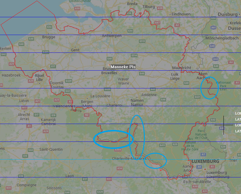
My first test was to project the belgium border data on an existing map ...
Q) Is here someone who used open street map for a project ?
and can help me with better results ...
thanks,
marco
use of open street map ...
- every professional was once an amateur - greetings from Pajottenland - Belgium -
PS: sorry for my english I speak flemish ...
Re: use of open street map ...
did you see: viewtopic.php?f=27&t=66320&hilit=pbmap
WARNING: I dont know what I am doing! I just put stuff here and there and sometimes like magic it works. So please improve on my code and post your changes so I can learn more. TIA
Re: use of open street map ...
"Manneke Pis" was funny
Sorry not really contributing
Re: use of open street map ...
It's not uncommon. Where your vector data are from ?
Re: use of open street map ...
thanks,
manneke pis is just a very touristic attraction in Brussels ...
i just needed some test data
more info :
https://nl.wikipedia.org/wiki/Manneken_Pis_van_Brussel
marco
manneke pis is just a very touristic attraction in Brussels ...
i just needed some test data
more info :
https://nl.wikipedia.org/wiki/Manneken_Pis_van_Brussel
marco
- every professional was once an amateur - greetings from Pajottenland - Belgium -
PS: sorry for my english I speak flemish ...